Learn Your Forest
A self-guided field trip through the Twisp Restoration Project
As we continue to discuss the Twisp Restoration Project with the Methow Valley Ranger District and the North Central Washington Forest Health Collaborative, we wanted to provide a glimpse of what we’re looking at on the ground. Many of the proposed thinning prescriptions of the Project can be seen along main forest roads throughout the watershed.
The next time you are going up Twisp River or Thompson Ridge roads, take some time to stop at these sites and see firsthand the variety and breadth of this project. As you walk beneath the trees, notice how the forest exists within gradations. Forests change their character, structure, and species mix within a couple hundred yards due to water availability, elevation, aspect, soil type, and fire and logging history. Such complexity can make it challenging to implement landscape-scale thinning and burning prescriptions. In an effort to address site specific conditions present in many of the most sensitive habitats, we’ve encouraged the Okanogan-Wenatchee National Forest to mark trees slated to be cut so that we can envision the impact prescriptions would have. At each site, we encourage you to imagine a picture of the forest after thinning and ask yourself: Is this what I want it to look like?

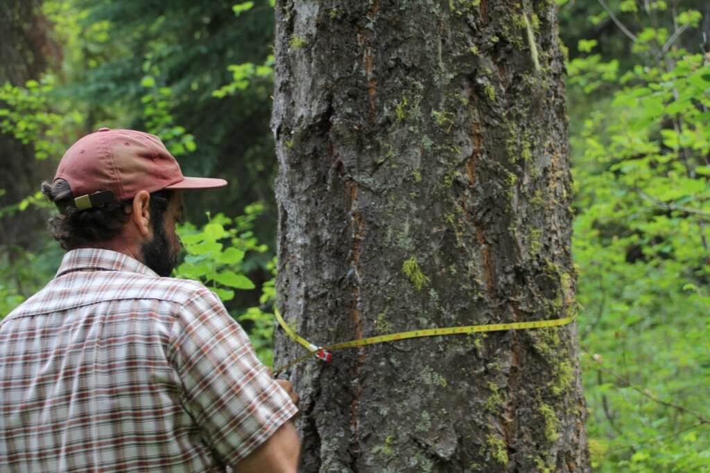
Public Lands Coordinator Sam Israel measures a Douglas fir in the Twisp Restoration Project near Poplar Flat campground. Sam is working closely with the North Central Washington Forest Health Collaborative to ensure the project results in healthy, resilient forests
POPLAR FLAT CAMPGROUND—THE VERY BEST THE TWISP RIVER OFFERS
As you’re driving up Twisp River Road, right around War Creek you’ll begin to see a shift in the forest structure. Ponderosa pines and Douglas firs widen in girth and stretch far into the sky. You are in a mature late-successional forest. While these trees would hardly be considered giants in wet western Cascade climes, on these eastern slopes they are pillars of a healthy forest. Many are 150–200+ years old!
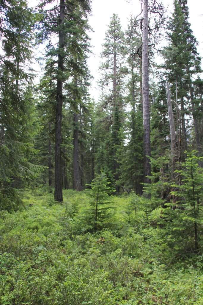
Pull off at the Poplar Flat Campground and find a small, unmarked dirt 2-track across the road (north) from the entrance to the campground. Walk north on this road for about 100 yards to a clearing with a dispersed campsite and fire ring. Look east and you’ll see a prime example of a healthy spacing between trees within a Late-Successional Reserve (LSR). Several widely spaced ponderosa tower over a sparse understory. Midsize trees provide canopy structure in clumps. Here the aim is to protect and enhance the conditions of old-growth forest ecosystems.
The thinning prescriptions here vary depending on your distance from the road. Within 200 feet of the road, the LSR Shaded Fuel Break prescription would keep 20–30 of the largest trees above 10” in diameter. Trees up to 21” in diameter could be cut (unless they were moderately infected by dwarf mistletoe, which creates an exception to cut 25” trees). Beyond the 200’ shaded fuel break, to the toe of the slope above, the LSR Risk Reduction Thin would retain an average of 40–50 trees per acre greater than 10” in diameter. In both prescriptions, the forest canopy would be opened significantly. If you look north from the fire ring you’ll see examples of closed canopy conditions where smaller trees are crowding a 45” ponderosa and providing ladder fuels for fire to carry into the crown. These trees would be removed to create space for the larger tree.

Looking east from the road north of Poplar Flat. A prime example of a mature Late-Successional
Reserve stand. Large, old ponderosas
dominant the overstory, trees are widely spaced, and there are multiple age classes.
Now picture how this forest might look with 20–50 of the largest trees (in clumps) per acre. Walk 100 steps into the forest straight in one direction, turn 90 degrees and walk another 100 steps. Repeat twice more until you’ve completed the square. Estimate the number of trees in your square. In stands of widely-spaced ponderosas, the forest may be close to the desired density. In other areas many trees must be cleared. As you’re imagining the future forest, consider these questions: What should a mature forest in this region look like? Would the thinning prescription proposed here help to make the forest more resilient in the face of cli[1]mate change and improve its ecological function? How would the shaded fuel break look from the road? How would it prepare the forest to fight a wildland fire?
BETWEEN POPLAR FLAT AND WAR CREEK—VARIABILITY IN LATE SUCCESSIONAL FORESTS
On your way back down the Twisp River between Poplar Flat and War Creek, notice how the tree densities change. In some stands, densities might exceed 150– 200 trees per acre of mostly small diameter trees. Here it could be beneficial to keep all the 21” trees, even if they have some mistletoe. Large trees are already deficient across these landscapes due to high-grading where the best and biggest were cut and the rest were left. In these dry forests, larger trees take a long time to grow to a size which can withstand disturbances such as fire and drought. The variation present along the road shows us the importance of walking the land and marking the trees.
WAR CREEK—A QUICK STOP IN OWL HABITAT
Pull off at the trailhead to the War Creek campground and walk to the north side of the Twisp River Road. Here you are in an owl habitat improvement area. The aim in these stands is to improve habitat for not only northern spotted owl, but also other late successional species such as white-headed wood pecker, goshawks and marten who prefer old forest with multiple canopy layers. Here trees up to 25” in diameter (if they had some mistletoe) could be removed if they were within 30 to 40 feet of the trunk of a larger tree. Again, whether this is the best prescription varies based on where you are in the forest.

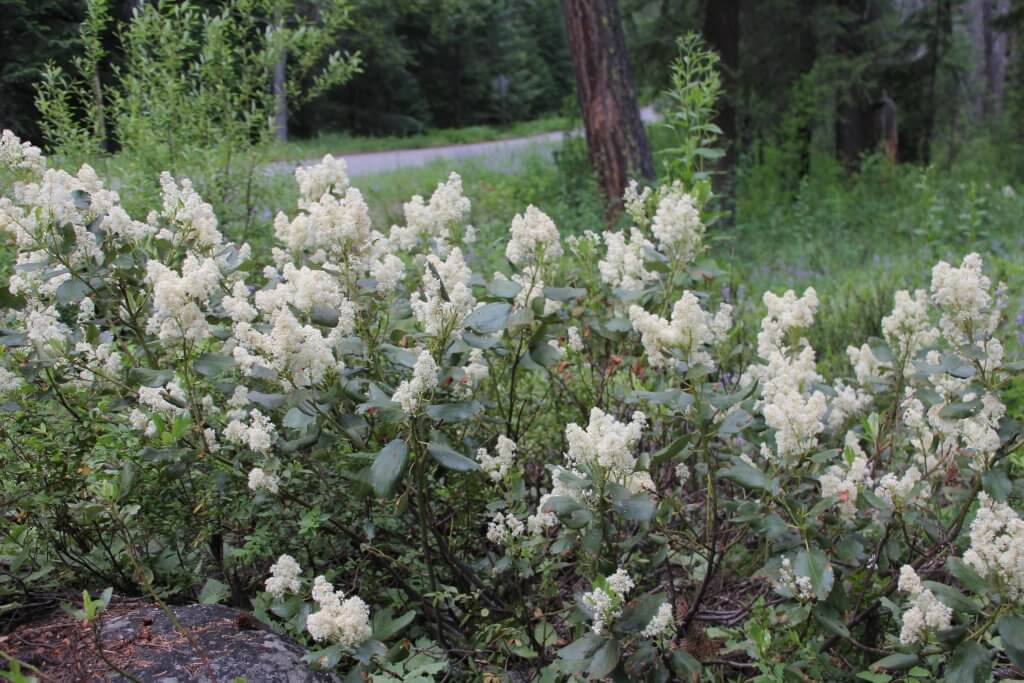
When the canopy is opened up, or after a fire disturbance, Ceanothus can thrive. Unless it is controlled by frequent burning, it can create a fire hazard on the landscape.
Though clearing an area around a large tree gives room for it to grow, it also increases the amount sun hitting the forest floor. Open canopies can cause a proliferation of brushy understory growth. At War Creek you may notice a waxy-leaved, sweet smelling bush of Ceanothus. This species flourishes in hotter, drier sites with southern exposures. When fire hits it, it bursts into flame like a lit match. It begs the question which is worse: a forest free of ladder fuels or a forest choked with tinder-prone brush? Understory vegetation along with ladder fuels can account for up to 80% of the fire risk in the forest. Ideally, the brush will be cleared out by understory prescribed burning. However, this practice would need to be carried out frequently and could stretch the capacity of the Forest Service.
THOMPSON RIDGE ROAD— ENTER THE MATRIX
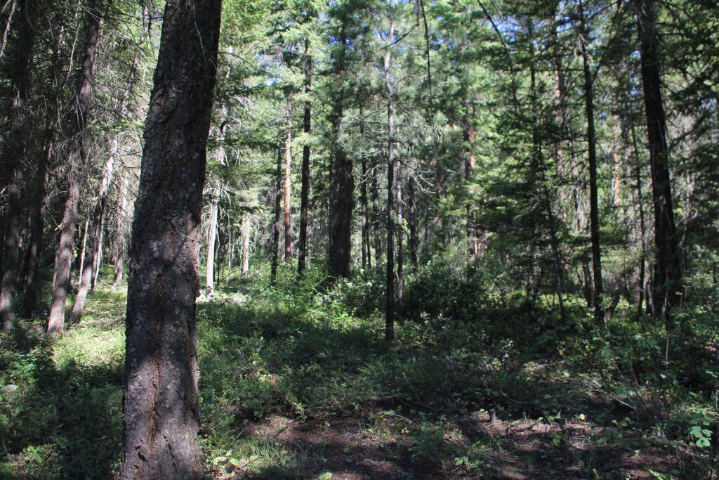
The drive between Chickadee Trailhead and Twisp River Road on Thompson Ridge Road provides a prime example of areas within the matrix — a land allocation within the Northwest Forest Plan that allows for more intensive commercial logging. The matrix land base contains the largest amount of overstory thinning prescriptions within the Twisp Restoration Project covering approximately 13,500 acres of forest. Upon leaving Chickadee Trailhead, you’ll notice a marked difference in the forest structure from the Late-Successional Reserve. It is hard to see through the forest in many places—the canopy is closed and light barely filters to the forest floor. Living in the Methow Valley, we are used to being in forests like these—many of them surround our prime recreation corridors. However, closed canopy forests lie outside the historical range of conditions for the eastern slope of the Cascades, where low to moderate intensity fires would often clear out the understory and leave only the largest trees. With the Matrix Thin, the Restoration Project is attempting to return the forest to a park-like ponderosa pine dominant system.

A closed canopy in the Matrix. Here it could be beneficial to remove many of the smaller diameter trees to allow the larger Douglas firs to grow.
Just before Rader Creek, walk just off the road to see an example of where thinning the understory of small Douglas firs could benefit the growth of the few moderately-sized trees. Many trees between 15–21” might be kept here to maintain the prescription of 20–40 trees per acre greater than 10” in diameter.
Further up the road, you can pullout at the junction for the Climb-It mountain bike/hiking trail. Look uphill to see an opening in the forest where legacy ponderosas dwarf nearby trees. This illustrates the structure which the Restoration Project would like to eventually create here. Trees take a long time to grow and such a prescription may not look natural for some time. Can we adjust our expectation of what a “natural” forest should look like in our recreation areas while we wait for the forest to grow?
