Fuelbreaks: The Appropriate Response to the Threat?

MVCC Winter Book Club: Active Hope by Joanna Macy and Chris Johnstone
October 4, 2021
Mosaic Burns: A Closer Look at the Cedar Creek Fire
October 18, 2021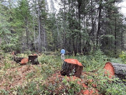
Fuelbreaks are often used in firefighting to slow a fire as it approaches a road or to provide a buffer to fight fire from or light back burns from. The effectiveness and necessity of fuel breaks has been questioned by prominent foresters and scientists as a recent white paper written by Ali Palm and Mike Liu of Conservation Northwest suggests.
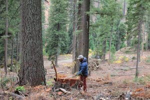
In the Cedar Creek and Cub Creek fires this summer, dozens of miles of fuel breaks and dozer lines were put in to slow the fires. Some were effective. Others were not. Although effectiveness is challenging to measure (dependent on a variety of factors including fire conditions at the time) what we focused on in our recent tour through the Cedar Creek fire were the following questions: Where and when were these fuel breaks put in? What was cut out of them (how far off the road and the size of tree)? What is their position on the landscape and how far were they from the fire? What is their proximity to homes they were meant to protect? The necessity of a fuel break depends completely on context.
War Creek to above Poplar Flat
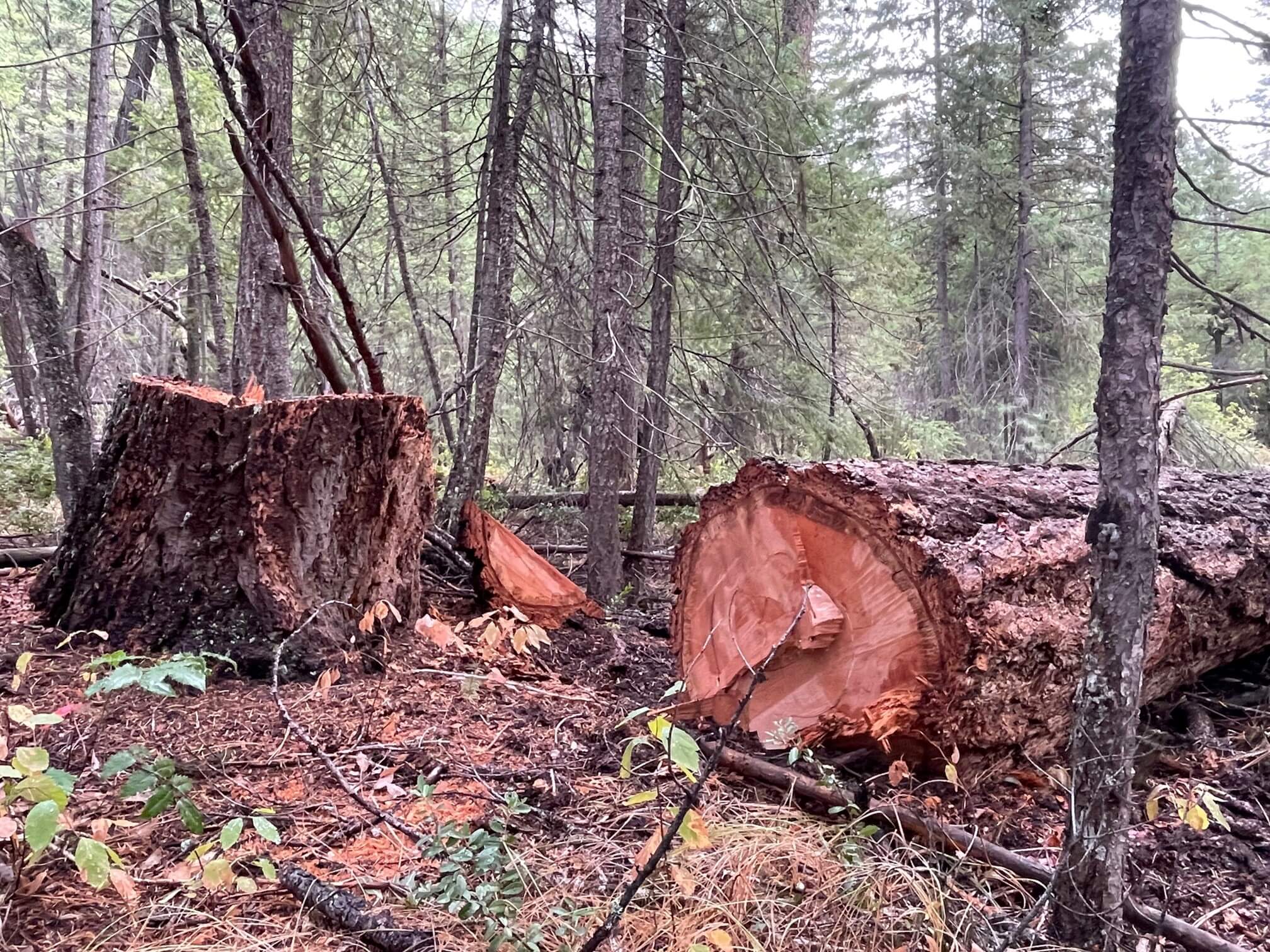
Heavy equipment used. Most snags 25-35 inches were cut over a 5 mile section. Large landing zones created in old-growth habitat. Significant ground disturbance. Cuts extended up to 2500 ft off the road and a large quantity of flammable slash was left on the ground. Poplar Flat is 8 miles from the nearest home in the Twisp River and this logging was conducted in early-mid August when direct fire threat was minimal – the fire was 4 miles away on the other side of Abernathy Ridge, a rocky escarpment that provides a natural break.
This fuelbreak was in a rare old forest providing invaluable wildlife habitat. This area, designated as a Late Successional Reserve under the NW Forest Plan, was slated to be treated as a Shaded Fuelbreak under the Twisp Restoration Project – a treatment that MVCC and other local organizations questioned during the DEIS review process.
Below War Creek
Limbing and some understory thinning was done by hand for 50-100 feet off the road. This is an area that is both closer to homes in the Twispavia development and near Buttermilk Creek.
This approach of treating the fine fuels, understory brush and removing dead lower limbs (sometimes referred to as “ladder fuels”) is very effective. Fire scientists have suggested that the largest portion (over 80%) of the fire hazard on our forests is in the surface and ladder fuels, rather than the overstory trees.
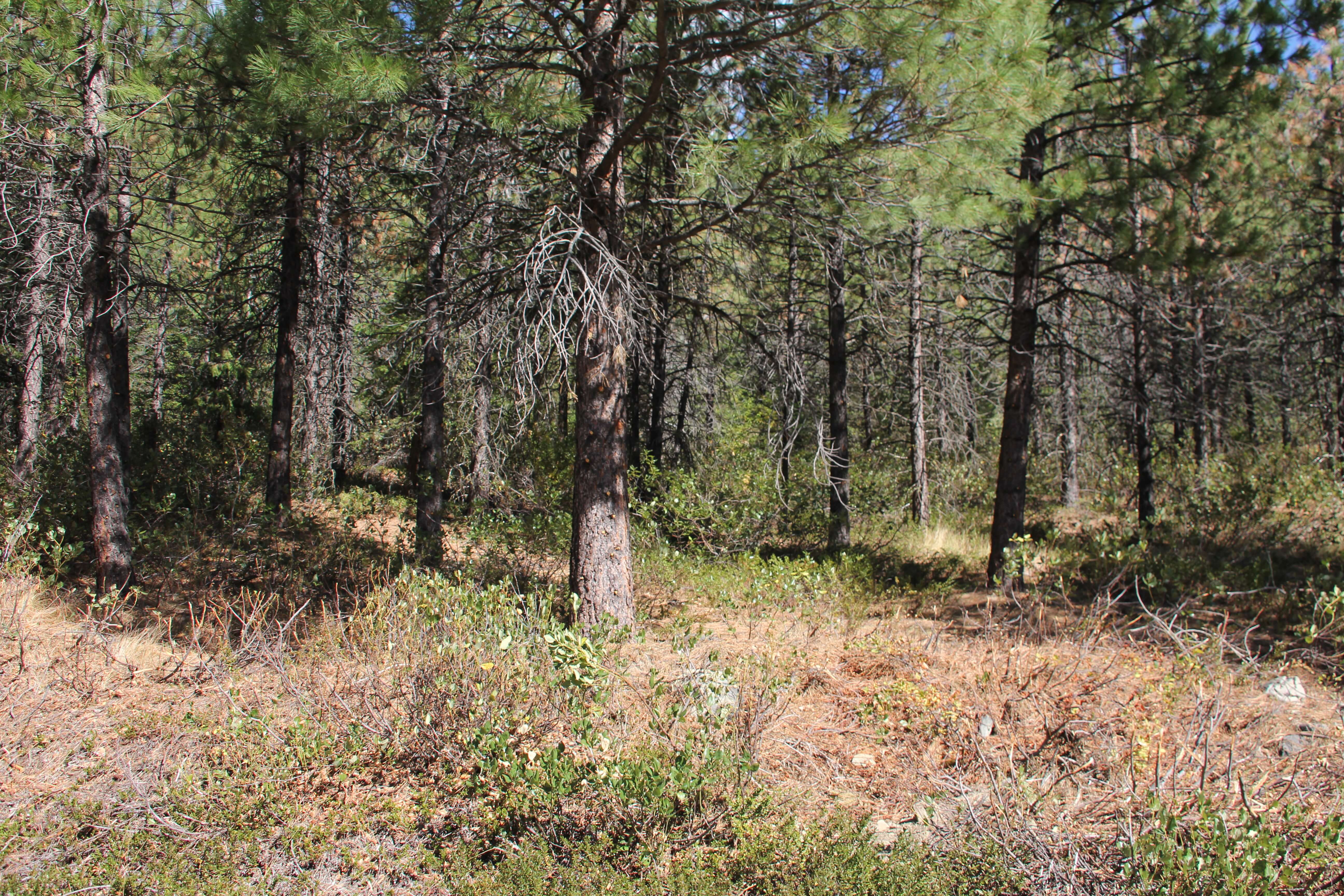
Along Wolf Creek Road
Effective thin of understory trees for 50ft off the road. Close to many homes. Fire burned up to road or road was burned off of. The forests around this area on DNR land were previously treated during the Virginian Ridge timber sale and show us how thinning and burning treatments can be effective.
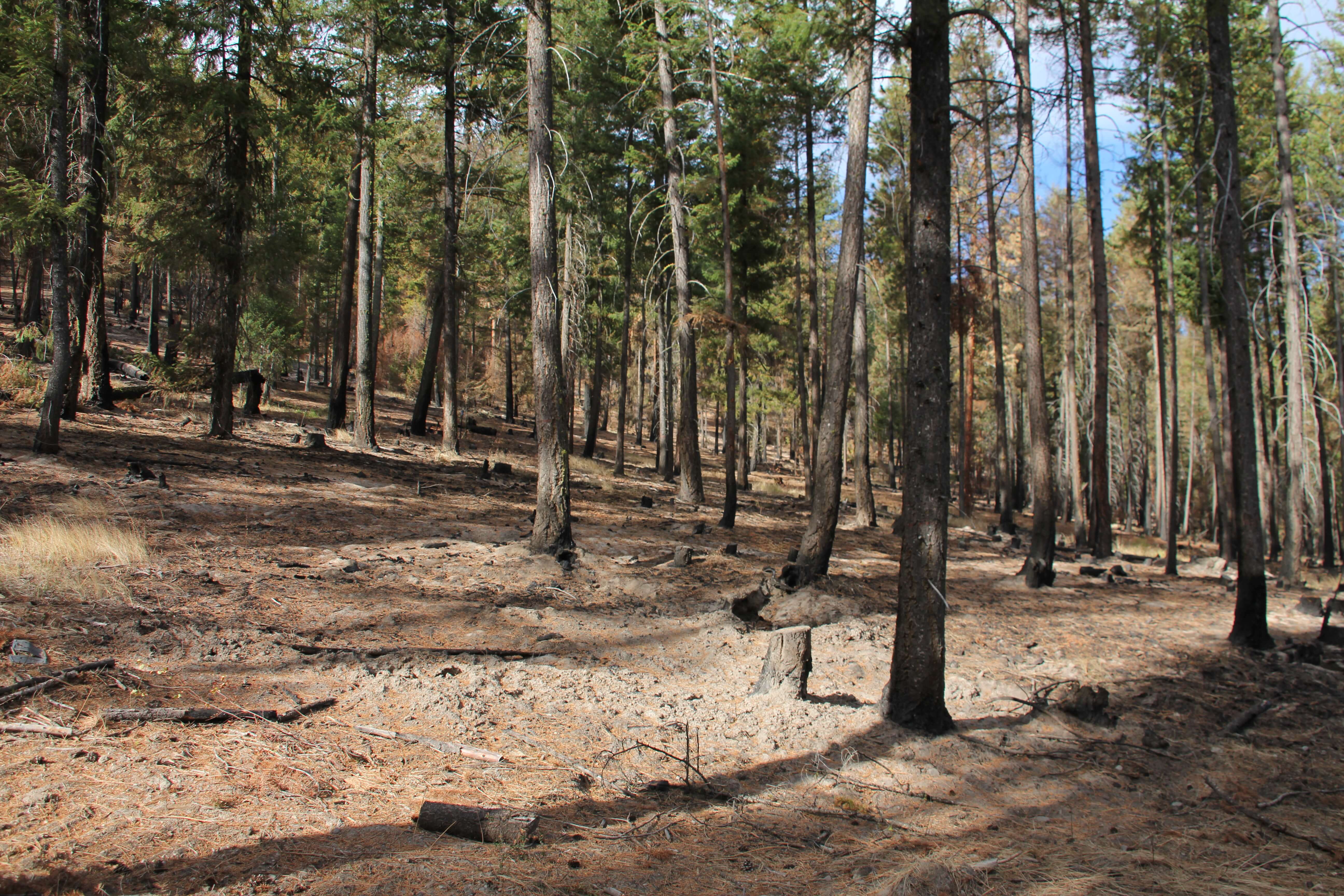
Upper Bridge Creek
A fuelbreak on the north side of the road. The fire did not reach this fuelbreak, although it did burn up to the break further down the drainage. Had the fire gotten over this road, it would have had to climb through the sparser fuels of the Bridge Creek Fire and up over rocky Abernathy Ridge to reach the upper Twisp River Valley. Large trees 25-35 inches were cut out up to 250 feet from the road.
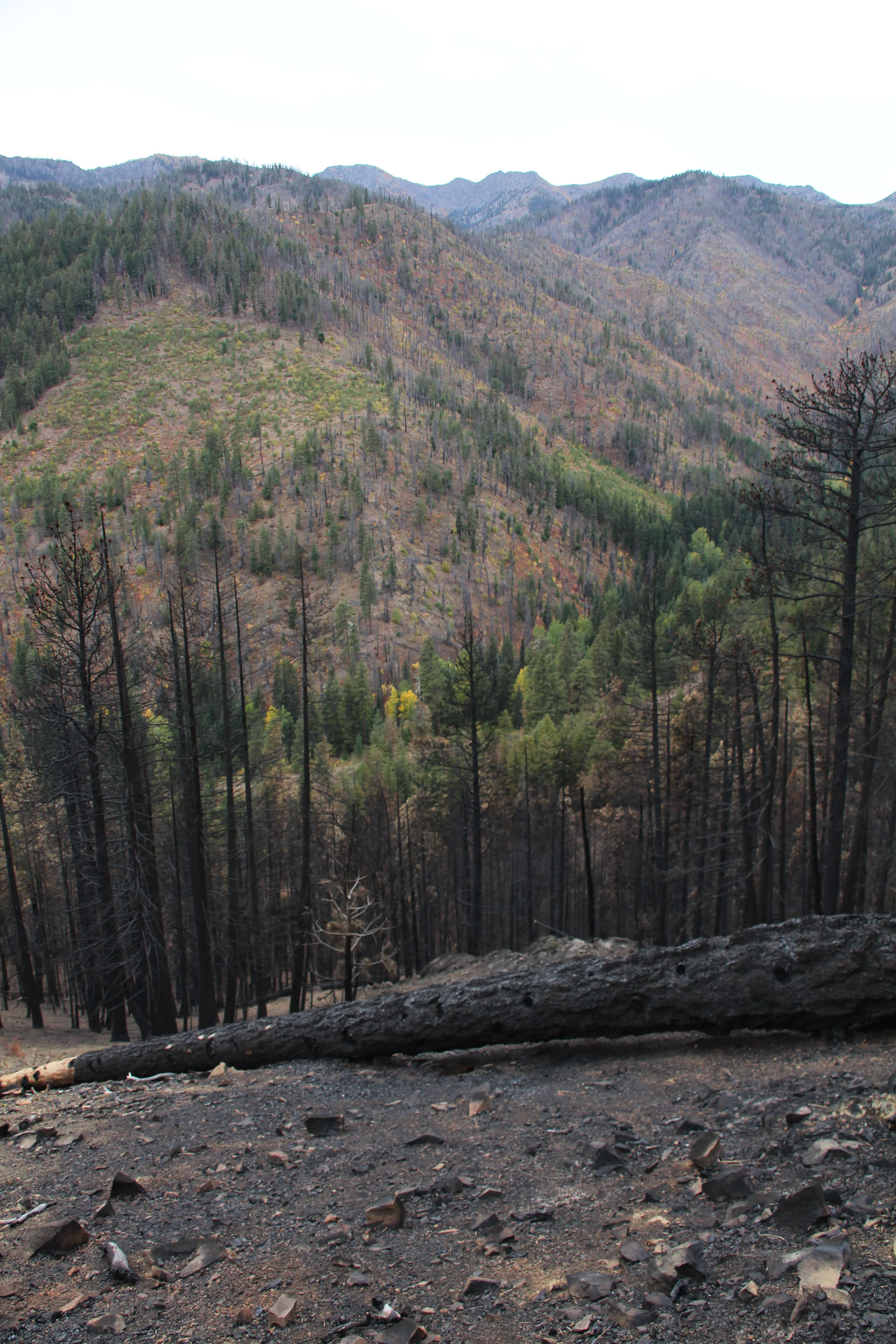
Looking south from where the Cedar Creek fire burned in Little Bridge Creek towards the 2014 Bridge Creek burn scar. In the distance is Abernathy Ridge. To reach the upper Twisp River Valley, the fire would have had to cross the burn scar, gone over the rocky escarpment of Abernathy Ridge and backed down 5,000 vertical feet to the Valley floor.
