Mosaic Burns: A Closer Look at the Cedar Creek Fire

Fuelbreaks: The Appropriate Response to the Threat?
October 18, 2021
Twisp Restoration Project Downsized
November 17, 2021Over the last few weeks as roads within the fire perimeter have opened up, we’ve gone out to ground truth what we’ve only previously seen on maps or heard in briefings. We’ve focused our efforts on Cedar Creek as many of the roads in Cub Creek are still closed. As we’ve explored within the red line of the fire perimeter, we’ve tried to answer some questions: How did the landscape benefit from this fire? How can we manage our forests to prepare them for future fires? How can we make sure that after a fire we are left with only the natural disturbance of the fire instead of human disturbance and fragmentation too?
Mosaics
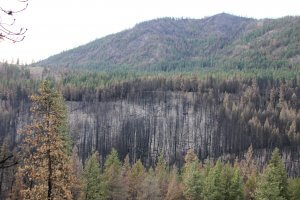
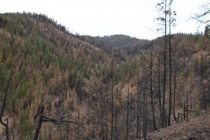
Ecologists have long supported the idea that a moderate, fairly frequent ecosystem disturbance maximizes species diversity. Where there is not enough disturbance, or too much disturbance, species diversity decreases. On the east slope of the North Cascades this intermediate disturbance, in the form of fire, should come through every 16-20 years. The Cedar Creek Fire burned at a variety of severities: low, moderate and high. Some areas didn’t burn at all. This fire pattern created a mosaic of varied patches (think quilt, or spatial heterogeneity if you’re going for the scientific term). As these patches see new growth in the coming years they will provide a wide variety of habitats.
Black-backed woodpeckers flock to severely burned trees to eat the wood-boring beetles from them. Ungulates and black bears chow down on the forbs and grasses that proliferate the next spring (see our blog post on the effects of fire on local wildlife), and unburned closed canopy forests continue to provide shelter for many species. Certainly some of this fire was detrimental

Looking south across Wolf Creek towards Gobbler’s Knob with Sun Mountain Lodge on the left. Notice the high severity fire in the foreground and lower severity fire behind it.
(especially large high severity patches up Sandy Butte and Wolf Creek) and will take many decades to recover. However, when a fire like Cedar Creek is looked at next to all the other fires we’ve had in the last 20 years—at varying levels of succession—you can see the potential for the formation of a rich forested landscape.
Having excluded fire for a long time, the Methow is bordered by many forests that are overstocked with Douglas fir and lacking in disturbance. One forestry management approach that can mimic fire disturbance and increase fire resiliency is thinning and prescribed burning. (Read more about this in Conservation Northwest’s white paper). This is the management approach proposed for much of the Twisp Restoration Area, which, if implemented properly, can make our local forests healthier and more resilient to climate change.
Fire Journaling
While we can quantify the percentage of soil burned at different levels of severity and the potential for erosion, it is far more challenging to quantify how a fire renews a landscape. One major challenge is scale and time—burned areas don’t transform into complex, diverse ecosystems overnight.
One way to observe the changes on a landscape is through fire journaling, an emerging form of nature journaling that can combine art, writing, and scientific inquiry. Over time these journals can help us to assess how a burned area is recovering and the habitat it is providing. We know that many of our members are artists, photographers, writers, scientists or observers of the natural world. To help us tell the narrative of fire and all its impacts—positive and

An example of a fire journal entry from Miriam Morrill.
negative—we’d like to invite you to share your fire observations with us. In time we hope this fire journal on our website can serve as a repository of local knowledge about the impacts of fire on our backyard forests. You can submit pictures from your fire journal, photos, observations, questions or hypotheses that come up to our Communications Manager, Nick Littman at nick@mvcitizens.org who will be doing his own long-term fire journaling.
For more inspiration and resources visit our Citizen Fire Journal on our website.


