Announcing New Methow Valley Clean Air Citizen Monitoring Project!

Open Roads Coalition Tells County: Remove the Gates!
July 22, 2018
MVCC is moving and we need your help!
September 11, 2018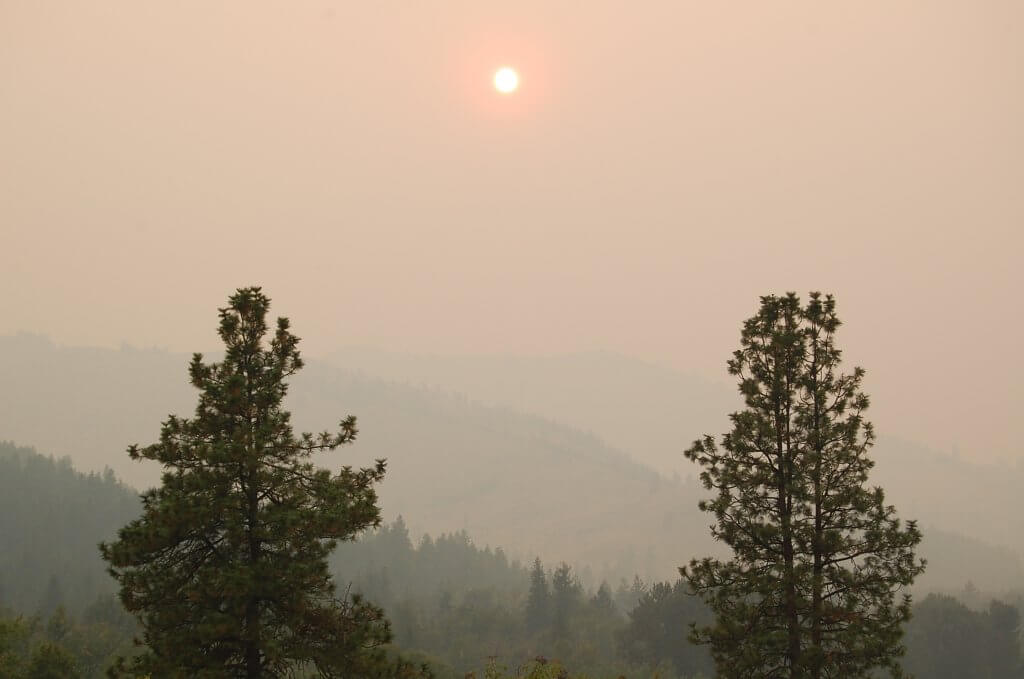
Our vision is to place at least 12 more sensors throughout the valley to provide a much more comprehensive map of air quality than previously possible from the two Washington State Ecology nephelometers located in Winthrop and Twisp. For example, during the first few days of the Gilbert Fire, our sensors have shown that hazardous air quality out Twisp River and near Benson Creek has fluctuated throughout the day with wind shifts, while air quality in Mazama, Big Valley, Studhorse, and Balky Hill has remained at healthy to moderate levels. The Twisp and Winthrop ecology nephelometers only reflect air quality conditions close to those locations.
![purple air[7434]](http://www.mvcitizens.org/wp-content/uploads/2018/08/purple-air7434.jpg)
![pair 11 am[7433]](http://www.mvcitizens.org/wp-content/uploads/2018/08/pair-11-am7433.jpg)
Project overview
Phase 1 of the project utilized grant funding from the Methow Valley Fund to purchase 10 sensors which are located with our Ambassadors at the following locations listed north to south:Bush School
Mazama Trailhead
Weeman Bridge
Lower Studhorse
Town of Winthrop (co-located with Ecology monitor)
Methow Valley High School
Town of Twisp (co-located with Ecology monitor)
Upper Twisp River
Balky Hill
Benson Creek
Phase 2 of the project was enabled by generous donations from community members and organizations, and another 10 sensors will be placed at the following locations by the end of August. Stars indicate we have not yet confirmed an Ambassador in this area.
Lost River Airport*
Little Star Montessori in Winthrop
Twin Lakes
Gunn Ranch trailhead*
Chewuch/Rendezvous
Sun Mountain/Pine Forest
Lower Twisp River (closer to town)
Carlton
Libby Creek*
Texas Creek*
Methow*
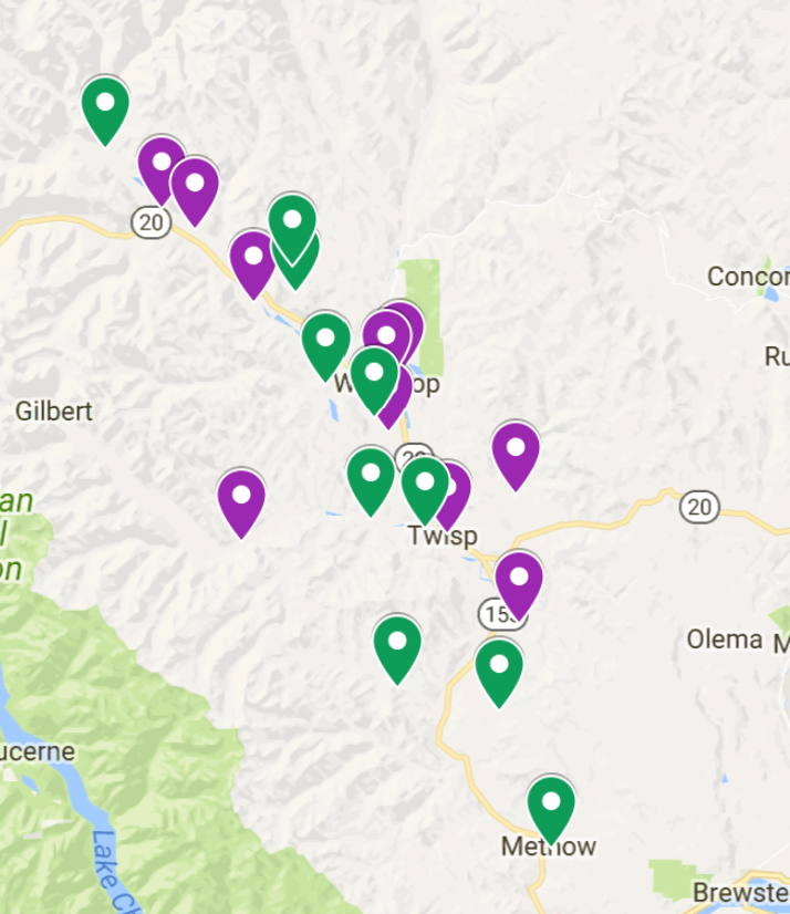
Purple indicates Phase I and Green Indicates Phase II
Next steps for the Clean Air Ambassador Program
This project is truly unprecedented in its scope and potential impact for a small, rural community such as the Methow Valley. We have big plans to learn as much as possible and share that knowledge to help other rural communities consider how they might utilize similar sensor networks to build air quality awareness and improve public health. It’s exciting to note that we are also collaborating with the Okanogan River Airshed Partnership who is also utilizing the purple air sensors to monitor air quality.
We are currently seeking funding to expand this exciting project in the following ways:
Build a website to display our local network of air quality sensors, with additional resources on air quality, health effects of particulate matter, and local initiatives underway to improve and protect our airshed.
Update the Methow Air app, currently available for iOS from the app store, to include the data from the new sensors, and develop an Android-compatible version of the app.
Expand our network of sensors and Clean Air Ambassadors to additional locations and elevations to further map air quality in the valley.
More education and outreach to promote air quality awareness; develop effective risk communication messages about health effects of air pollution; and measure impact on community behavior.
Integrate the Clean Air Ambassador program and sensor network into a comprehensive community “smoke-readiness and response” public health initiative.
And more… additional programs could include using the network for K-12 educational programs, monitoring and reporting impact of smoke from prescribed burns, and improving meteorological modeling of smoke predictions using network data.
How can I participate?
We are seeking additional participation and funding for this exciting project!
1.) Become an Ambassador! Being an Ambassador and hosting a sensor requires nothing more than an enthusiasm for promoting clean air in the valley and a commitment to our simple steps to ensure high data quality from your device. If you live in one of the Phase 2 locations starred above, or another location please contact us at cleanairambassador@gmail.com. Depending on your location, we may have a sensor already secured for you to host, or we may ask that you purchase your own sensor to participate.
2.) Give! We have so much more we can accomplish with this project sponsored by the Methow Valley Citizens Council. Please specifically indicate you’d like to support the work of the Methow Valley Clean Air Project when making your donation to this 501c3 non-profit by check to PO Box 774 Twisp.
3.) Tell a friend! If you think this is a cool project or know someone who might, please spread the word. If you’d like to keep up on activities of the Methow Valley Clean Air Project, please like our Facebook page.
A few more notes…
Interpreting the air quality index
Important to note is that as air pollution levels increase, these low-cost sensors are known to consistently overestimate particulate levels up to two-fold. We are working to develop an appropriate “correction-factor” by co-locating sensors with our Washington State Ecology local nephelometers and the federal reference monitor in Omak to better understand how the sensor readings track with these more sophisticated devices across varying temperatures and humidity.
Another notable feature is that the value shown on the purple air map is a real-time air quality index that changes every eighty seconds. Concentrations of particulate matter (micrograms/m3 of air) are translated into an air quality index number and associated health risk color according to the EPA AQI. If you click on a particular sensor, you can see a variety of data displays of recent air quality information from that instrument. Note that the color-coded system to communicate health risk was developed by EPA for 24 hour exposures. Understanding the health effects of acute, or short-term exposures to heavy air pollution such as from wildfire or prescribed burn smoke is an important area of active research.


A note about health effects of PM2.5 and smoke
While the EPA’s color-coded air quality rating system was developed to provide guidance for precautions to take to protect your health, everyone is different. You may not need an orange or red day to begin experiencing symptoms. We encourage you to pay attention to your body in poor air quality conditions: if you are bothered by the smoke, especially if you are experiencing wheezing or difficulty breathing, try to find or create clean air and seek medical attention. Indoor air purifiers with true HEPA filters remove 99.75% of particulate matter .3 microns or smaller and can be extremely effective in creating safe breathing conditions even in heavy outdoor smoke. If you must spend time outside, we encourage you to wear a N95 or N100 mask. While studies conclusively show poor health outcomes from chronic (i.e. months to years) exposures to poor air quality, the effects of acute (i.e. days to weeks) exposures to smoke, such as that from wildfires, have not been well characterized. However, increases in emergency room visits and asthma attacks are strongly correlated with air pollution episodes. Bottom line, if you have the ability to reduce your exposure to smoke, do it! More information about the health risks of smoke can be found at the following links:
Health Information Washington Department of Health
Wildfire Smoke, A Guide for Public Health Officials
EPA AirNow and Health